Maps with scales in centimetres.
In every map the scale used to make it is included. Using that key, we can know precisely any distance in reality. To calculate the distance on a map between two cities, follow these steps:
1st Measure with a ruler the distance between the two cities on the map.
2st Multiply the result of your measurement according to the scale (the number that follows 1:*******).
3st Convert that distance into kilometers. How? Simple. Removing 5 zeros.
Actividad
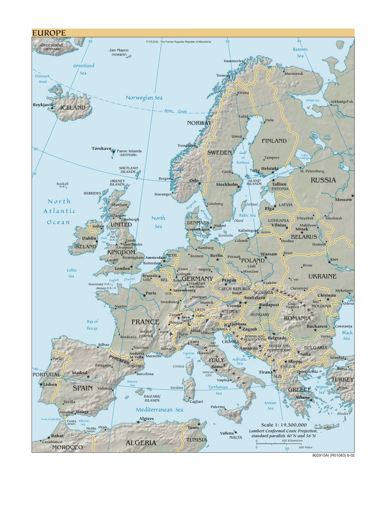
Use any atlas you have on hand, calculate the existing distance between Valencia and the following places:
LISBON ␣ BILBAO ␣ ZARAGOZA ␣ MADRID ␣ SEVILLE ␣ PARÍS ␣ LONDON ␣ LIVERPOOL ␣ BRUSSELS ␣ AMSTERDAM ␣BERLIN ␣ VARSOVIA ␣ PRAGUE ␣ ROME ␣ ZAGREB ␣ BUDAPEST ␣ BUCAREST ␣ KIEV␣ MINSK ␣ SKOPIE ␣ ATHENS ␣ RABAT ␣ REYKIAVIK ␣ MURMANSK ␣ OSLO ␣ STOCKHOLM ␣ RIGA ␣ HELSINKI ␣ HAMBURG ␣ LUXEMBOURG ␣ BELFAST ␣ BRATISLAVA ␣ CHISINAU.
If you do not have an atlas, you can use this map.